
Mojave Trails National Monument
Spanning an incredible 1.6 million acres across California’s Mojave Desert region, Mojave Trails National Monument was established on February 12, 2016. The monument borders Joshua Tree National Park to the south and Mojave National Preserve to the north, forming part of a vast and beautiful network of protected desert landscapes in Southern California.
Located just 30 minutes east of Twentynine Palms, Mojave Trails encompasses more than 350,000 acres of Congressionally designated Wilderness and protects a remarkable mosaic of rugged mountain ranges, ancient lava flows, sweeping sand dunes, and wide-open desert valleys. The monument also preserves irreplaceable cultural and historic resources — from Native American trade routes and World War II Desert Training Center sites to the longest remaining undeveloped stretch of historic Route 66.
Whether you’re drawn to hiking, stargazing, OHV exploration, rockhounding, wildlife viewing, or simply discovering the quiet beauty of the open desert, Mojave Trails offers an extraordinary diversity of outdoor recreation opportunities, all within easy reach of Twentynine Palms.
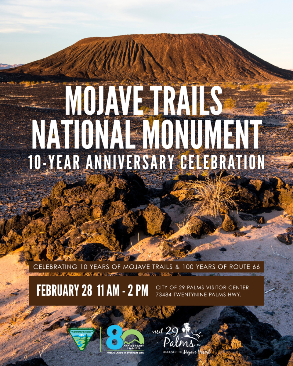
Celebrating 10 Years of Mojave Trails
In honor of the 10-year anniversary of Mojave Trails National Monument — and the upcoming 100-year anniversary of historic Route 66 — Visit 29 Palms, in partnership with the Bureau of Land Management, is hosting a special community celebration at the 29 Palms Visitor Center. We invite you to join us as we celebrate this remarkable desert landscape and the stories it protects!
As part of the anniversary, a special Mojave Trails photo exhibit is now on display at the Visitor Center through March 31, showcasing the monument’s diverse landscapes, historic Route 66 connections, and rich desert heritage. Guests are encouraged to explore the exhibit before or after the celebration and experience the beauty and history of Mojave Trails up close.
Mojave Trails National Monument Adventure Itineraries
Amboy Crater National Natural Landmark is a 10,000-year-old volcano and adjacent lava flows, located next to the original and iconic Route 66. Recognized for its visual and geological significance, Amboy Crater was first established as a National Natural Landmark in 1973 and is one of Mojave Trails’ most popular sites, offering a unique opportunity to experience and explore one of the youngest volcanic fields in the U.S. Day use area includes shade ramadas, picnic tables, vault toilet restrooms, paved road and parking lot, interpretive kiosk and scenic observation point. Due to the extreme heat the basaltic rock reflects, hiking to Amboy Crater is recommended only in the late fall through the early spring season.
Mojave Trails National Monument Recreational Opportunities
Hiking
Remember: Hiking opportunities on BLM lands are vast, but excursions require preparation. Well-maintained signage, visitor centers and gas stations may be few and far between. Always plan your adventure ahead of time and pack plenty of food and water.
Amboy Crater: One of the youngest volcanic fields in the United States, Amboy Crater is home to a National Recreation Trail that takes visitors to the rim of the crater. The route is roughly four miles out and back and is perfect for hiking between the months of October to April. Allow yourself a minimum three hours of hiking time. The cone is one-mile in circumference and is located 1.1 miles from the day use area. Follow the trail to the west of the cinder cone. This will take you to a wide opening where an explosive eruption had breached the crater wall and poured basaltic lava over a 24 square mile area. From here, the climb to the top is an 80-foot incline.
History: The crater is an example of a very symmetrical volcanic cinder cone formed during the Pleistocene geological period and estimated to be 79,000 years old. The most recent eruption was approximately 10,000 years ago. Since the 1970s, the geology of Amboy Crater’s lava fields has been of interest to NASA. The basalt lava fields have been used as test sites for Mars rover missions.
Wildlife Viewing
Bonanza Springs: Providing fantastic opportunities for wildlife viewing off the beaten path, Bonanza Springs is located in the foothills of the Clipper Mountains. Fed by the Fenner Basin aquifer, it is the largest spring in the Mojave Desert. Bonanza Springs is surrounded by mesquite and cottonwood trees, cattails and shallow water that supports catfish and bluegil. The spring water stretches for a half mile and provides habitat for frogs and toads. Accessing Bonanza Springs requires 4-wheel drive and a high clearance vehicle. Find more information at blm.gov.
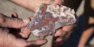 Rockhounding
Trilobite Wilderness/Marble Mountains: Rockhounding and invertebrate fossil collecting is a popular, family-fun activity practiced in the Mojave Trails area for the last 100 years. The Marble Mountains, a narrow volcanic range extending 12 miles, contains some of the most-well known Cambrian trilobite fossil sites within California and the Western United States. The fossil beds lie in a beautiful Latham Shale formation that is 60-feet thick and over 550 million years old. Trilobites are extinct arthropods that disappeared approximately 250 million years ago. The small marine crustaceans resemble modern-day horseshoe crabs.
Please follow Bureau of Land Management’s casual use regulations when collecting in the Monument. Find additional information on the Marble Mountains trilobite fossils here. Watch the Rockhounding in the Mojave Trails National Monument video.
Native American History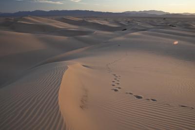
Mojave Indian Trails: The Mojave Trails area contains remnants of more than 10,000 years of human occupation and has been a critical travel corridor for millennia. The Mojave Indian Trail, used by Native Americans for thousands of years, is the earliest known route passing through the area. Native Americans who have lived in or passed through the Mojave Desert include the Chemehuevi people, the Shosone, Serrano, Kawaiisu, and the Paiute.
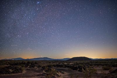 Stargazing
Mojave Trails boasts some of the darkest night skies in the California desert. The Bureau of Land Management and its partners are working to get the National Monument identified as an International Dark Sky Sanctuary. Experience the deep, dark night sky for yourself by visiting Amboy Crater. Just a one-hour drive from 29 Palms and located near historic Route 66, the site offers picnic tables, restroom facilities, and an ADA ramada overlook for viewing. Learn more about Mojave Desert Land Trust and their research in Mojave Trails at MDLT.org.
Off-Highway Vehicle Recreation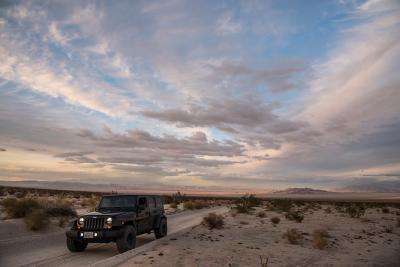
Mojave Road: This historic 138 mile route follows a series of watering holes across the scenic mojave desert and is increasingly popular with OHV enthusiasts. Mojave Road runs through the Piute Valley portion of Mojave Trails and passes through Mojave National Preserve. With 1.6 million acres of desert in Mojave Trails National Monument and over 1,200 miles of designated OHV routes, there is plenty to explore.
For more info contact the BLM Needles Field Office. Please visit the California Off-Highway Motor Vehicle Recreation site for rules and regulations regarding OHV use in the State of California. To register your off-highway vehicle, please visit the California Department of Motor Vehicles OHV site.
 Historic Sites
Desert Training Center/California-Arizona Maneuver Area: The DTC was created under the command of General George S. Patton in 1942 to train troops for African, Pacific, and European campaigns. Between April 1942 and April 1944, more than one million soldiers and 60 armored, infantry and artillery divisions, and fighter pilot and heavy bomber squadrons trained in the desert. They participated in what is considered some of the most realistic war games ever conducted under the harshest conditions imaginable.
Camps within the Desert Training Center: Camps Essex, Clipper, Coxcomb, Iron Mountain, Ibis, Granite, Rice and Pilot Knob in California; and Camps Bouse, Horn, Hyder and Laguna in Arizona. The BLM is working to list the Desert Training Center on the National Register of Historical Places. To protect this extraordinary chapter of America’s history, the use of metal detectors/removal of artifacts is prohibited.
Scenic Geology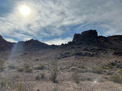
Snaggletooth: Mojave Trails National Monument offers expansive opportunities to hike and camp within unique formations made up of igneous, sedimentary and metamorphic rock. This mountain named Snaggletooth, rests in the southwest corner of the Chemehuevi Mountains and serves as a primitive campsite. Due to the beautiful geology and its close proximity to U.S. Highway 95, it is a great place to stay on your way to or from Las Vegas. To learn more about dispersed camping on your public lands visit blm.gov.
Bureau of Land Management Mojave Trails National Monument Resources:
Mojave Trails National Monument Website
Mojave Trails National Monument Interactive Map / PDF Map
Mojave Trails National Monument has also been featured in regional media, including coverage by The Desert Sun highlighting five must-see experiences within this vast desert landscape.
Always Leave No Trace
While enjoying your visit, help minimize your impact by staying on designated paths, packing out litter, respecting other visitors and wildlife, leaving natural and cultural resources as you find them, and following the Leave No Trace seven principles:
1. Plan Ahead and Prepare
2. Travel and Camp on Durable Surfaces
3. Dispose of Waste Properly
4. Leave What You Find
5. Minimize Campfire Impacts
6. Respect Wildlife
7. Be Considerate of Other Visitors
© 1999 by the Leave No Trace Center for Outdoor Ethics: www.LNT.org

